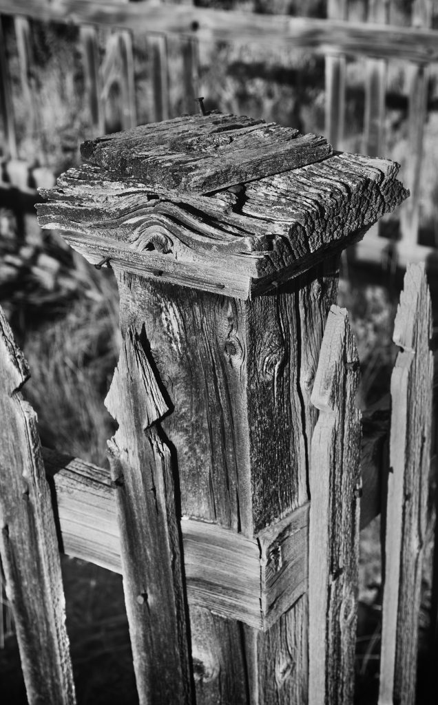
The above image is the corner post of a tombstone enclosure located in the Bannack State Park cemetery. The wood in these enclosures, many in a state of disrepair, show great texture from their time spent in the harsh weather conditions. It appears that the tombstone itself has been removed from most of the enclosures.
I processed the image using Google’s Nik Software Silver Efex Pro 2. If you use Photoshop, get the Nik Software collection. Besides being free, these plug-ins can add great effects to your image while simplifying your workflow.
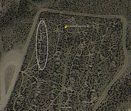
The approximate location of the above image is marked by the yellow pushpin on the Google Earth screen capture below. The white elipse on the picture shows the location of a several of these wooden enclosures. This set of enclosures line up nicely to serve as backgrounds for each other when shooting down the line.
Bannack State Park Cemetery N45 10 29, W113 00 55
During a recent trip to Montana we made a side trip to Bannack State Park. I first read about the park on a bicycle blog. The riders included a few pictures of the park buildings and I immediately added it to our itinerary (along with Yellowstone and Glacier National Parks, but more on those later).
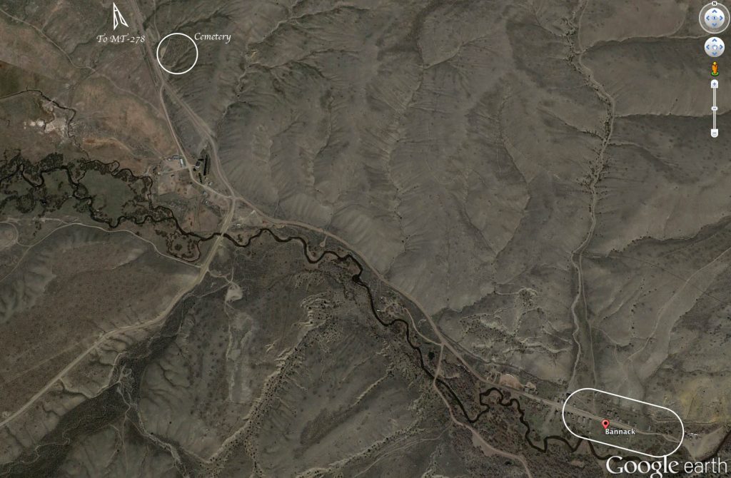
The Google Earth screen capture below shows two areas that provide numerous photography opportunities. There is a cemetery in the upper left of the picture and the main town in the lower right. There is camping allowed just outside the town, so there could be some great night photography for those so inclined. Dillon, the nearest town of substance, has several hotels and places to eat.
As shown in this image, the cemetery is pretty overgrown. There are many paths among the bushes to allow one to walk around easily. There is a sign at the entrance to the cemetery warning about rattlesnakes in the state park. My wife immediately returned to the car, but there were images to be had so I walked very carefully as I wandered around the cemetery.
Here is a panorama looking from the northeast corner of the cemetery to the southwest. The white blocks are obviously tombstones. Of more interest are the dilapidated wooden fences around many of the plots. These provide some interesting black and white images.
Here is an overhead Google Earth screen capture of the town itself. Vehicle parking is in the lot at the left edge of the picture. Camping is also just outside the left edge of the picture.
Finally, here is a panorama of the taken from a hilltop to the north of town. The parking lot is outside the right edge of the image.
That is a quick overview of the areas to photograph within Montana’s Bannock State Part. Future posts will present some of the images I created within the park. If you ever find yourself in the area, set aside two to three hours for your own photography.
Cemetery Parking: N45 09 44.34 W113 00 57.27
Town Parking: N45 09 44.34 W112 59 57.86


