
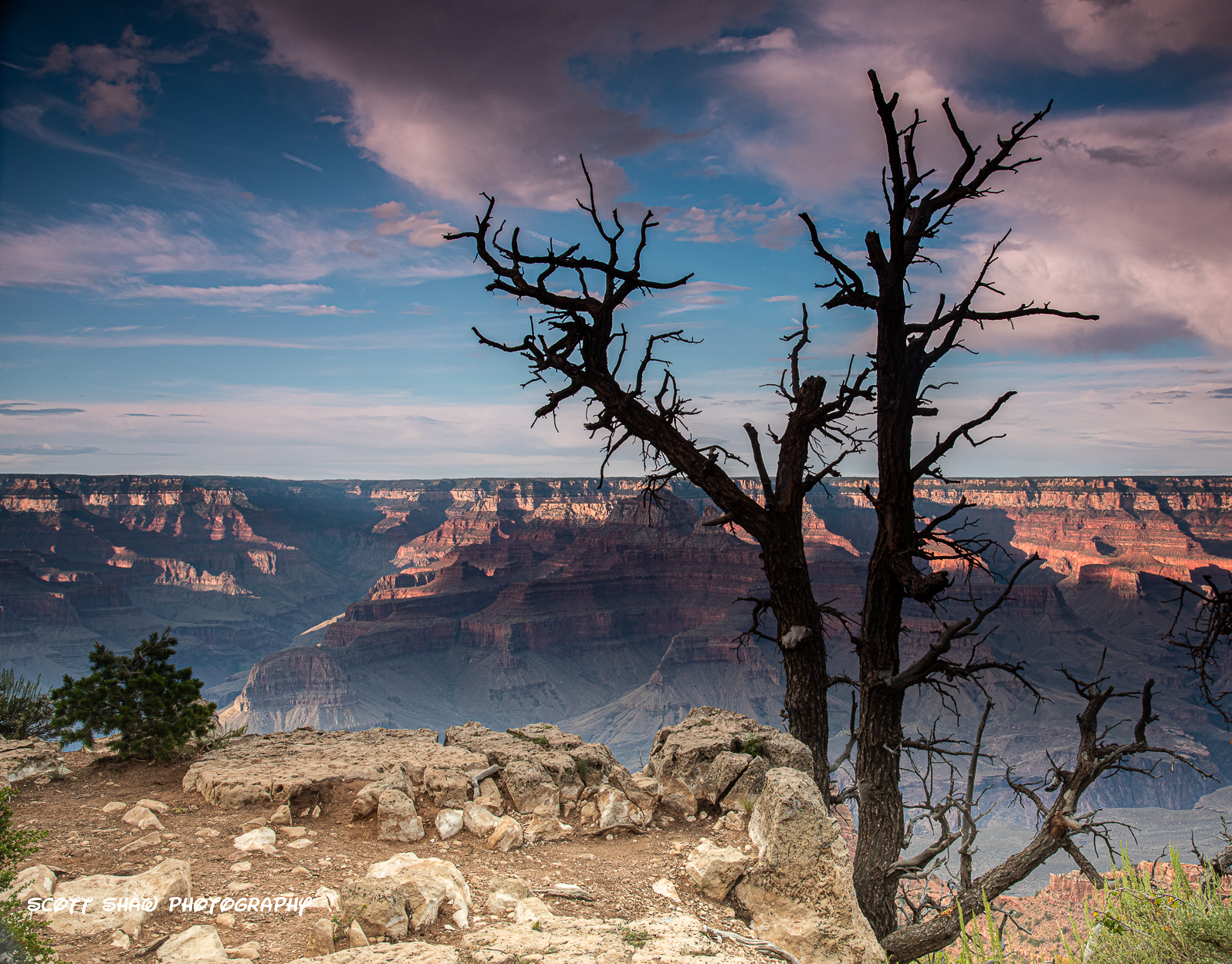
Nikon D810, 35mm, ISO 200, 1/3 sec, f/14
This is sunset on the Rim Trail at Grand Canyon National Park. To me, the interesting part is the tree. Notice how there is detail at the base of the tree, and it slowly transitions to a pure silhouette by the top of the tree. I found this to be an interesting effect.
This image also has a strong foreground with the rocks, a solid back ground with the various color shades along the far canyon wall, and a good sky!
Notice there are no fences. Just past the rocks in the foreground is the canyon itself!
Mather Point: 36.059373° -112.106439°
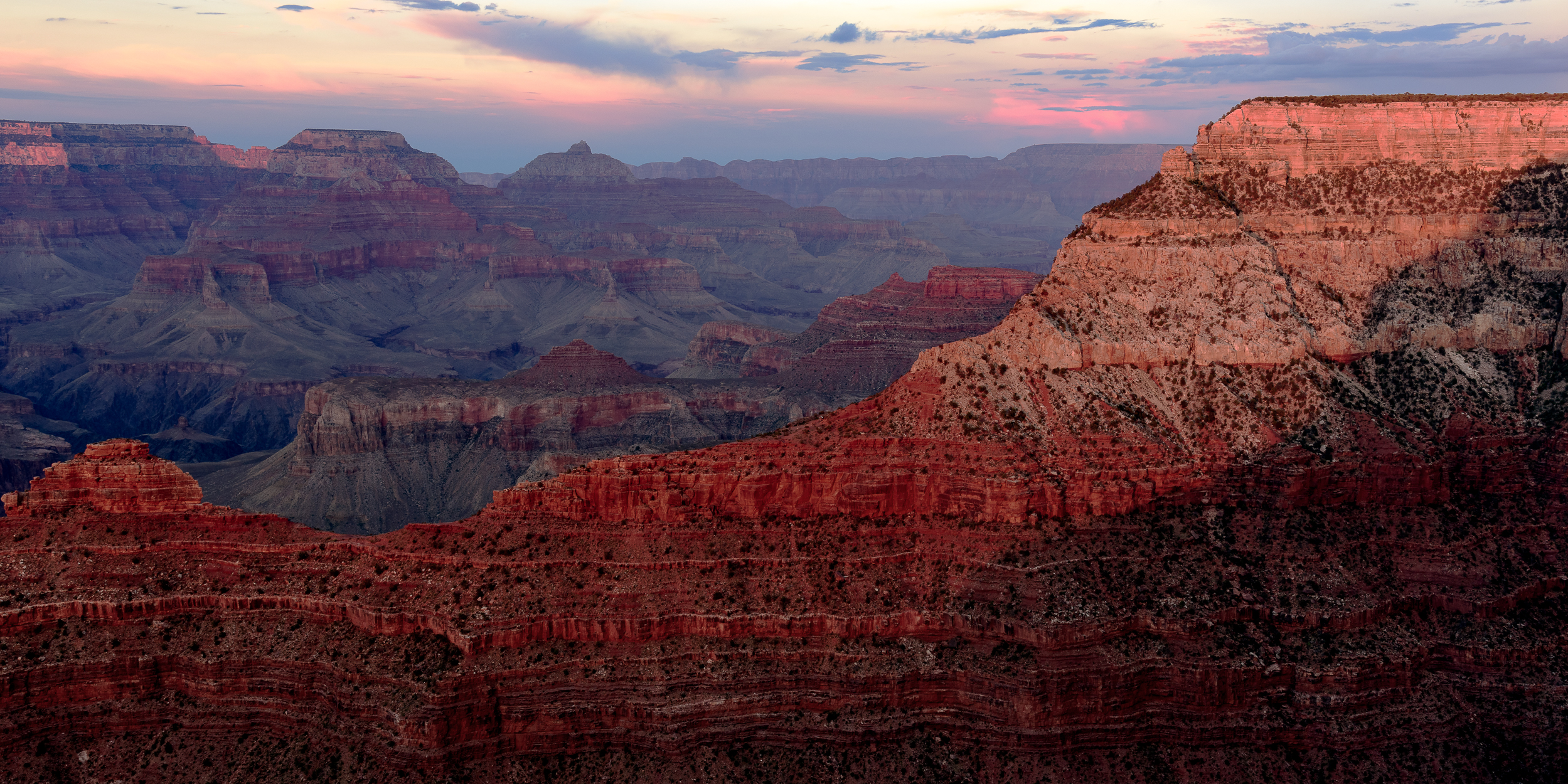
Nikon D810, 38mm, ISO 200, 0.4 sec, f/13
Mather Point, located at the Grand Canyon Visitor Center, was the first stop of my weekend. After flying into Phoenix and driving 3.5 hours, I arrived at Mather Point shortly before sunset. This is a very crowded place for sunrise and sunset.
Afterwards, I drove to my hotel in the town of Tusayan. Because this was a last-minute business trip, I did not have the required lead time to make reservations for lodging inside the park. Driving to and from my hotel added about 30 minutes to my day compared to staying in the park. This made for slightly longer days when photographing sunrises and sunsets.
While processing this image, I learned about Lightroom’s Dehaze slider. The Dehaze slider is designed to cut through haze and boost contrast and color. It works well on skies and clouds, and images like this where there is little detail on the rocks. The Dehaze slider does increase saturation, so sometimes you have to reduce the Saturation or Vibrance sliders. Click here for an excellent video that explains the Clarity, Texture, and Dehaze sliders.
Mather Point: 36.062016°, -112.107690°
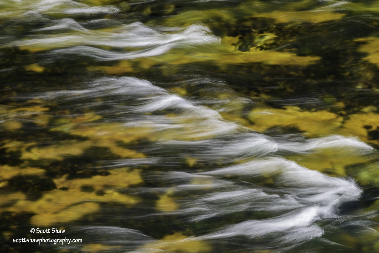
Yellowstone River Rapids (click to enlarge)
This image comes from the lower falls of the Yellowstone River. The Brink of the Lower Falls trail takes you from parking along North Rim Drive to the top of the falls. While the trail is pretty steep, views from the observation platform and noise from the water are well worth the effort.
Before arriving at the observation platform, the trail parallels to the Yellowstone River. There are several rapids along this stretch of the river that make for images with an abstract or watercolor effect. This image was taken with a shutter speed of 0.4 seconds, so use a tripod to eliminate photographer induced blur.
Yellowstone River Lower Falls Observation Area: N44 43 05.53 W110 29 46.81
